Glacier National Park - Part 1: West Glacier
Pre-trip
One year ago, I was sitting at home perusing the Glacier National Park website. By happenstance, I discovered that in-park lodging reservations were open for the next year! Rooms were quickly selling out. Excited and slightly panicked, I asked Cody if I should book lodging for us to go in August/ September 2024. We had met each other less than eight months ago. We liked each other, but who knew what our relationship would look like a year later! However, seeing that the cancellation policy was good, I decided to go ahead and reserve the accommodations. Happy to report that we still like each other, and we went on this exciting trip together!
Day 1 – Travel day
The days leading up to our departure were not the best. Cody was getting over a cold and the night prior I started breaking out in hives. The antihistamines barely kept it under control, and I didn’t get much sleep. We left early in the morning, had a short connection in Chicago, before arriving in Missoula that afternoon. Cody had rented us a car, asking for something along the lines of a small crossover SUV. What we ended up with was a white Chrysler Pacifica minivan. That was a surprise to us! Throughout the trip, Cody and I kept laughing to ourselves that at least 30% of Montana must drive a Chrysler Pacifica; we saw them everywhere!
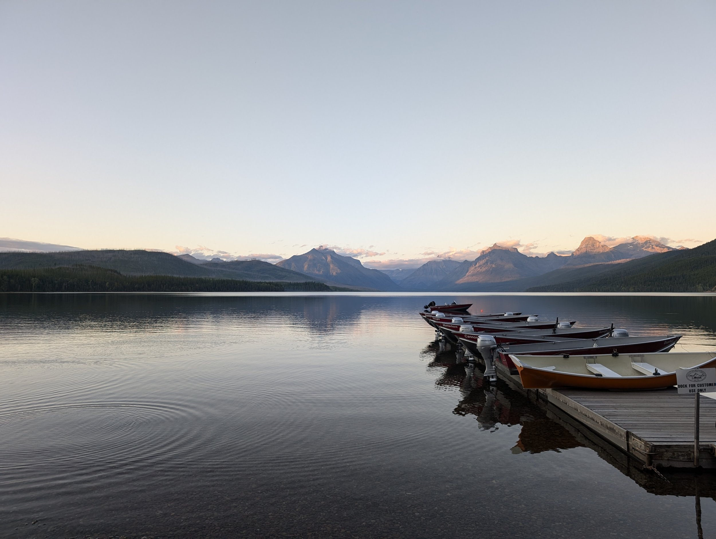
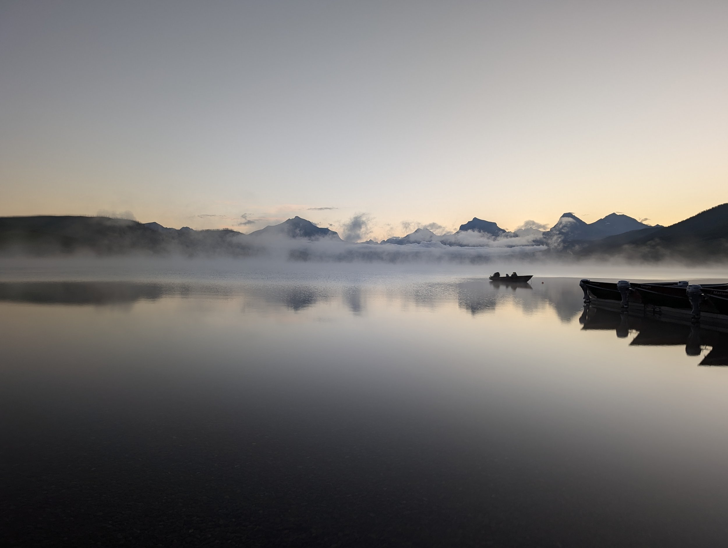
We ran errands before heading to the park. We went to REI and purchased a propane canister to help prepare our camp meals and Cody bought himself a very stylish sun hat (gotta protect that bald head!). We had lunch at Chipotle, then went to Walmart to restock on allergy medication and groceries. It was a 2.5-hour drive from Missoula to the West entrance of Glacier National Park. The first landmark we encountered was Lake McDonald, and we were in awe. The valley had been carved out by Ice Age glaciers; it is both the longest and deepest lake in the park, at about 10 miles long and 464 feet deep. It is surrounded by the mountains of the Continental Divide. The shoreline is filled with smooth, colorful pebbles, of white, green, blue and red hues. The water is so clear and serene.


Words and even photos do not do justice with how incredible the views are here. It is no wonder that George Bird Grinnell (the conservationist who was key to lobbying for the park’s creation) nicknamed Glacier the “Crown of the Continent.”
Day 2 – West Glacier: Trail of the Cedars to Avalanche Lake, Hidden Lake
We were fortunate to have a motel room within a few feet of Lake McDonald. We were excited to start our hikes for the day, but to do this safely, we rented bear spray from a nearby store. We couldn’t rely on our “toddler tossing” skills to protect us on the trails. If you don’t get an early morning start, driving and parking are horrendous, so we decided to try out the shuttle system. It wasn’t the best experience. Luckily, we were not in a hurry. We ended up waiting 1.5 hours at the Apgar Visitor Center, until there was space on a shuttle to take us to Avalanche Lake. While we were waiting in line, we met two ladies from Tennessee who were embarking on a 13-week road trip across the United States covering 17 national parks! A common theme among people we meet on our adventures is that our time is limited on earth, and we should do as much as we can, while we can still do it. These ladies had talked about losing many of their friends recently, and how they did not want to miss out on these opportunities to explore and see beautiful things.
Avalanche Lake
The Trail of the Cedars is an easy walk that is well-shaded with a combination of boardwalks and dirt paths. This trail is well-trafficked, but Cody and I were still anxious about a bear encounter; we had our bear spray and were doing our best with clapping, talking, singing, to make our presence known on the trail. This loop trail connects to the Avalanche Lake trail. We were surrounded by pine trees, and it smelled like Christmas. At the end of the trail, the trees open to stunning views of the lake. The waters are so clear blue and pristine, surrounded by mountains and waterfalls. It just didn’t seem real!
Length: 5.9 miles
Elevation gain: 757 feet
After we completed this hike, we hopped back on the shuttle to go to Logan Pass (the highest drivable point at the park at 6,646 feet), via Going to the Sun Road. With the popularity of the park, to drive on this road between 6 am to 3pm, you need to have a vehicle reservation. The alpine areas of the road are closed much of the year (closures can range from October to July) and other times when there is snow. The roads are also narrow with rock overhangs, so there are vehicle size restrictions too. The shuttle buses are smaller and can only carry 12-15 passengers at a time, leading to backups at the shuttle stops.
Once we got to the visitor center at Logan Pass, Cody and I were hoping that there would be some food options. We did not have cellphone service to check, and unfortunately, there wasn’t really anything there. We supplemented our trail snacks with gift shop foods of a gluten-free brownie, a small can of pringles, and a cliff bar. Even though we were disappointed with our food options, at least there are flushing toilets!
Hike #2 of the day, Hidden Lake
We were low on calories, but high on enthusiasm, so we trekked on to conquer Hidden Lake trail. The trail is gorgeous. You start on a boardwalk and then transition to dirt and rocky trails. You are surrounded by the mountains (Clements Mountain, Garden Wall, Mt. Oberlin, Bearhat Mountain) and wildflowers, and later pine trees, with views of the lake ahead. We saw our first wildlife on this trail including ground squirrels, groundhogs, mountain goats, and bighorn sheep. Many people stop at the overlook after 1.3 miles, but Cody and I decided to continue to the shore of Hidden Lake. The trail continues for another 1.4 miles, and there is a steep descent of about 770 feet over a short distance. Going down is hard on the knees, but going up is just plain exhausting. Little did I know, this would end up being one of the easiest hikes on our trip.
Length: 5.1 miles
Elevation gain: 1338 feet
We were tired and hungry after our hikes for the day, but we still had a while to go before the shuttles would take us back to our motel. The lines were long, and there were grumbles that someone had driven their car into the cliff side, further delaying transportation. Eventually, we made it back to Apgar Village. We got dinner from Eddie’s, sharing a huckleberry cider at the bar, and then getting takeaway of a chicken Caesar salad and fish and chips.
Total distance walked: 14.87 miles
Day 3
Today was a quieter day. The weather forecast didn’t look great, with anticipated rain starting in the late afternoon continuing until the next day. We woke up early and were the first people to rent kayaks for the day. It was a short walk to Lake McDonald. The lake was so serene. The water was clear, and we could see the pebbles at the bottom of the lake. Due to the mountainous environment and sometimes sub-freezing temperature of the lakes, algae and plankton are not able to survive, lending to the clear waters of the lakes here. It took me a while to get used to steering the kayak and feeling comfortable on the water, but this was one of my highlights of the trip.
Perfect kayaking conditions on Lake McDonald
After kayaking, Cody and I shared an ice cream (salted caramel and cookie dough). The food options are limited, so we were back at Eddie’s for lunch, again having the chicken Caesar salad and fish and chips.
Later in the day, we drove up to Logan Pass to take engagement photos. The rain started to pour down, and Cody kept repeating “rainbow,” on the drive, hoping that the weather conditions would improve. Overall, they did not, but it was still a fun time.


